The Other New York City:
Domestic Futures for a Zone in Transition
Foundations in Design Practices
(Core studio for third-year BS Arch - Design Thinking students)
University of Virginia School of Architecture
Fall 2021
The Other New York City: Domestic Futures for a Zone in Transition is 2021’s iteration of Foundations in Design Practices, the required studio for third-year undergraduate students entering the Design-Thinking concentration within the B.S. in Architecture at the University of Virginia. The studio introduces students to a range of urban-scale research and design practices within and beyond architecture and urban design.
The Fall 2021 studio builds on previous studios taught by Assistant Professor Devin Dobrowolski under the title “The Other New York City.” Sited in the New York metropolitan region, these studios have investigated “the relationship between Manhattan and the outer boroughs as a staging ground for analyzing, testing, and prototyping experimental approaches to the expanded field of architecture, landscape architecture, urbanism, product or industrial design, and their associated design practices.”
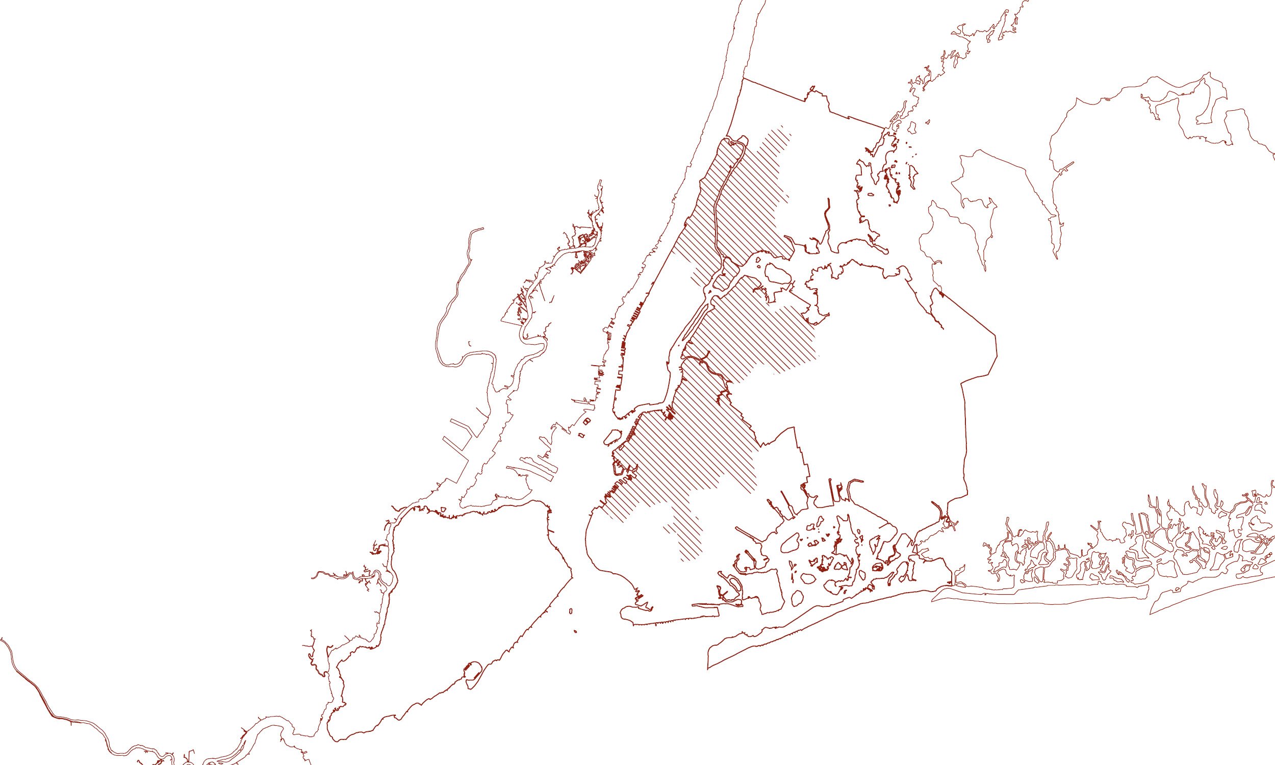
Domestic Futures for a Zone in Transition focuses on the band of middle-density neighborhoods across upper Manhattan, the South Bronx, eastern Queens, and North and Central Brooklyn that together make up the city’s “inner ring.” These were the neighborhoods built up with rowhouses and walk-ups in the early decades of the twentieth century; the neighborhoods that soon thereafter experienced white flight, redlining, and disinvestment. In the later twentieth century, they were the neighborhoods where new immigrant groups settled, and where real estate investors began to exploit a widening rent gap, spurring waves of gentrification in the 2000s and 2010s.
This history of transformation calls to mind Ernest Burgess’s classic description of the American city as a series of concentric “zones.” As the early-twentieth-century metropolis expanded, Burgess argued, these zones would ripple outward, with a semi-industrial “zone in transition” pushing out from the urban core toward surrounding residential rings. Burgess’s schematic relied on racist conceptions of immigrant “invasions” and a shockingly teleological account of “succession.” Yet as a spatial description of New York, his diagram remains suggestive. What would it mean to conceptualize the city’s inner ring as a distinctly dynamic “zone in transition” between urban edge and center?
Today, inner ring neighborhoods are undergoing another series of dramatic transformations. They have become battlegrounds in the city’s gentrification struggles, as well as contexts for new experiments in urban domesticity. They have been the sites of rezoning studies and the epicenters of Black Lives Matter protests. They have faced the brunt of Covid-19 and recent extreme flooding but have also been the cradle for new economic initiatives and new forms of collective life. In short: New York’s inner ring is the dynamic geography whose future may well chart the future of the city as a whole. It demands urbanists’ attention as a distinct geographic entity, one that might be approached in its entirety with strategies of design thinking at an urban scale.
The studio engages this geography through the specific lens of housing and domesticity. Understanding housing as the most fundamental and ubiquitous of urban infrastructures, the studio has used housing as a common point of entry to a broader range of urban processes, from real estate, to climate resiliency, to historic preservation, to social service provision.
Students began the semester with an intensive exploration of cartographic data visualization. Working first individually and then in pairs, they defined a topic of research interest, developed a hypothetical project through abstract diagrams, and deepened their understanding of a process or site through analytic drawings. The resulting design proposals have been conceived as prototypical interventions, firmly located in a neighborhood or site, yet indicative of future possibilities across the inner ring. They remain sketch concepts, but each suggests a larger argument about the role of design in the 21st-century city.
Module 1: Critical Cartography
Working individually, students developed a series of maps exploring a single topic at multiple scales.

Emily Rong

Caroline Abel

Ashley Kim

Aliyah White
Module 2: Investigative Drawing
Working in pairs and building on their previous research, students defined a topic of research and developed analytic drawings and data visualization to define initial “hunch” that would drive their subsequent design project. Parallel digital skills workshops taught techniques for integrating ArcGIS with Rhino via Grasshopper.

Ashley Kim and Marian Roshdy: Co-Ops, AirBnBs, and Maintenance Code Violations

Stephen Liechty and Leigh El-Hindi: Office Vacancies
Module 3: Operative Design
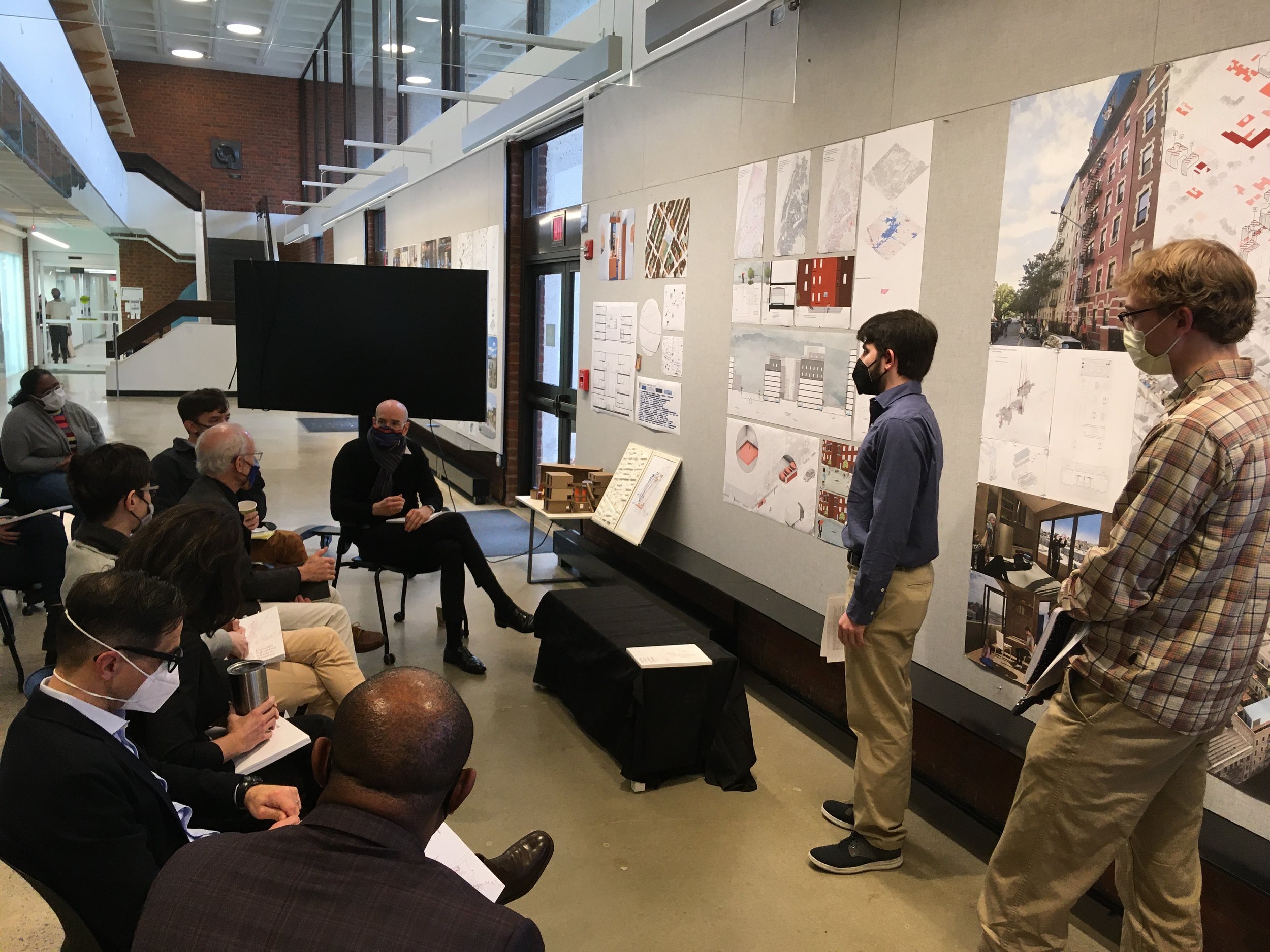
Students had wide latitude to develop their research into a design prototype for New York’s Inner Ring. The studio’s final output was a print publication, where students had to articulate the arguments behind their design proposal in writing as well as drawings.

The Micro-Hotel Model
Ashley Kim and Marian Roshdy’s project proposes that rooftop micro-hotel pods could help preserve naturally occurring affordable housing by providing cash flow to struggling coops.

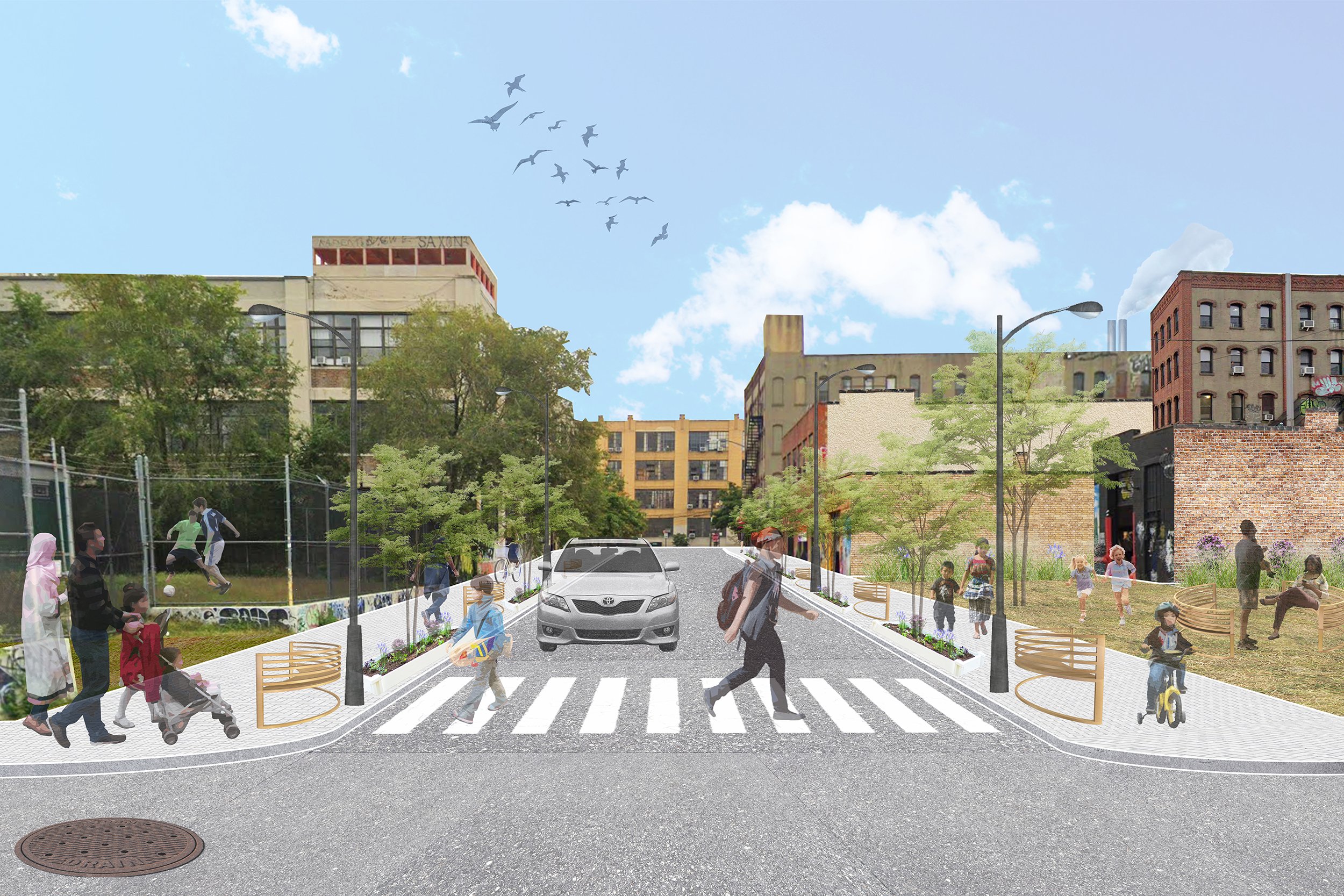
The Makings of a Permeable City
Eric Guilfoyle and Yianni Spears prototype a “resiliency block” in Williamsburg. Public flood control infrastructures are augmented by networked, small-scale private water retention installations in order to prevent stormwater flooding.

Collective Scales
Young people have unique housing needs, argue Teo Blazquez and Perri Dinnerman. Their proposal makes use of small publicly owned lots to create clusters of affordable micro-apartment buildings with shared amenities.
The Eco-Social Trail
Plans for remediating Newtown Creek largely leave out BIPOC communities in Bushwick and East Williamsburg. Emily Rong and Anna Wei propose knitting a series of vacant lots into a public park and trail, providing residents access to a newly remediated creek across an active manufacturing district.

Network Equity Support Tool
Aliyah White and Chloe Hellerman’s research suggests that while many resources exist for homeless people in New York, the digital divide and lack of centralized information make it difficult for the unhoused to find applicable resources. “Network Equity Support Tool” is a series of parking-space-sized neighborhood “hubs” that provide access to a new digital interface.

Officing New York
Leigh El-Hindi and Stephen Liechty propose to use the mounting office vacancy crisis to address an impending eviction crisis. Flexible wall modules create domestic cubicles for the rehoused.

Protecting Jackson Heights
Caroline Abel and Taylor Brown ask what it would mean for the New York Landmarks Preservation Commission to preserve culture, not facades. Intensively drawing and annotating a commercial corridor in one of New York’s most diverse neighborhoods becomes an opportunity to imagine an alternative preservation framework, one that combats commercial gentrification rather than facilitating it.